
The Jōgasaki Coast is located in the east of the Izu Peninsula, where lava flowed from a volcano that erupted 4,000 years ago and has been eroded by seawater, creating a complex coastline.
There are many hiking trails along this Jōgasaki Coast, with many sights and observation points along the way.
This time we started from JR Jōgasaki Kaigan Station and walked along the Jōgasaki Picnic Course and the Jōgasaki Nature Study Path to Izu Kōgen Station. The walk was about 11 km.
🇯🇵 この記事を日本語で読む: 城ヶ崎海岸ハイキング完全ガイド:城ヶ崎海岸駅から伊豆高原駅まで11kmを歩く!絶景の吊り橋と「キンメ電車」を満喫
Jogasaki Coast Hiking Overview: What You Need to Know
- Jogasaki Picnic Course: Easy, paved, and family-friendly.
- Jogasaki Nature Study Path: More rugged, with volcanic rocks and narrow trails. Hiking shoes are highly recommended!
- Public Toilets: Available at Renjiki-ji Temple (halfway point).
Phase 1: The Jogasaki Picnic Course (Easy & Paved)
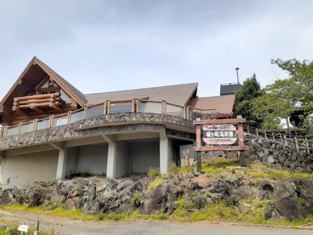
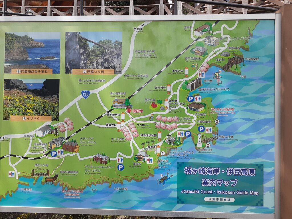
This is the start of the Jōgasaki Kaigan Station. We had hoped that there would be a tourist information centre nearby, but there isn’t. It is a quiet station. Instead, there was a map outside the station, so I took a photo.
Walk straight (southeast) out of the log cabin station.
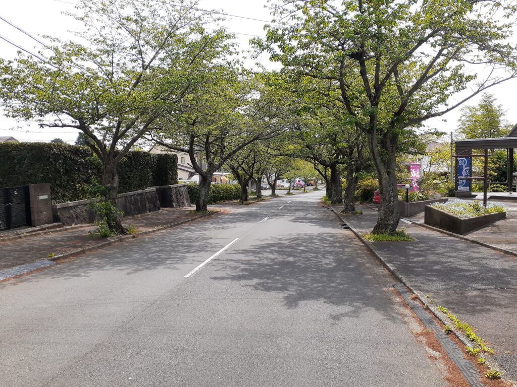
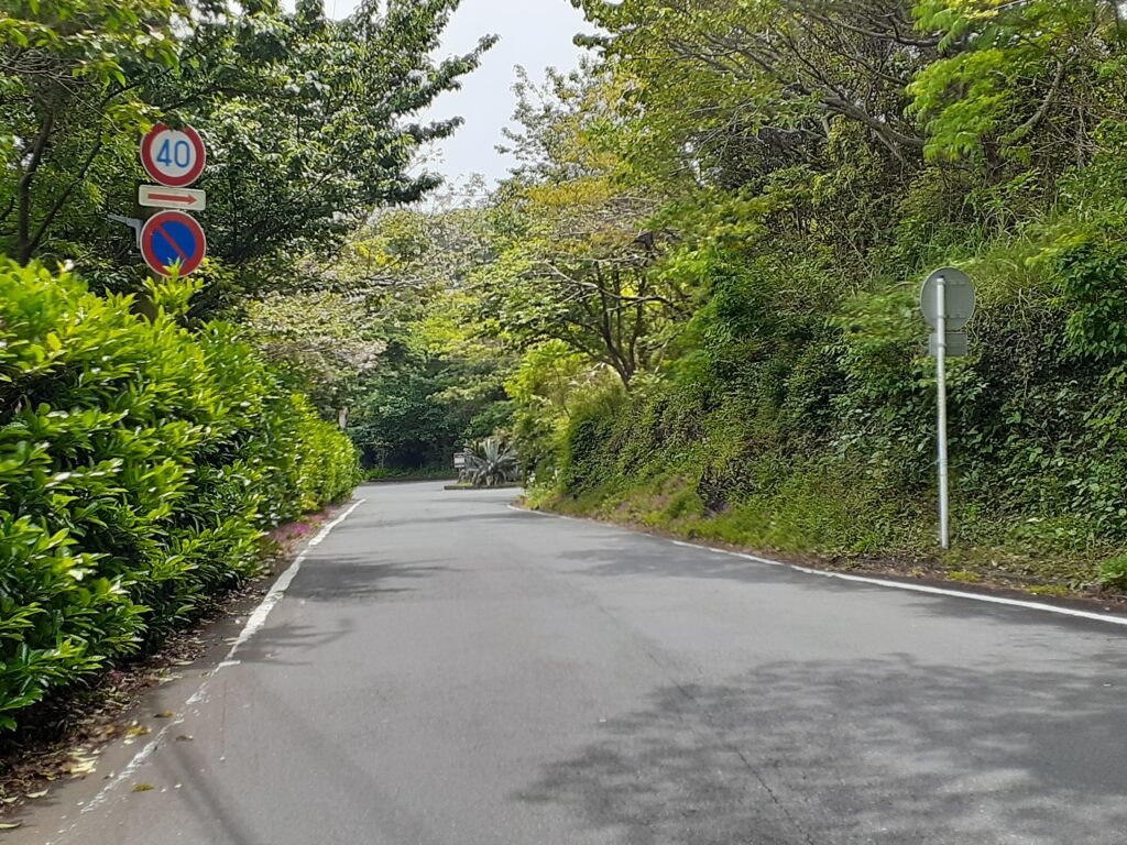
This road was lined with cherry blossom trees, but they were already in leaf now. Shame. After a while you come to a slightly bigger roadway, so turn left there. There is a bicycle lane on this road.
After walking along the road for a while, you will see a sign for Kadowaki Suspension Bridge, so turn right. At the end of the road there is another sign, follow it and turn right.
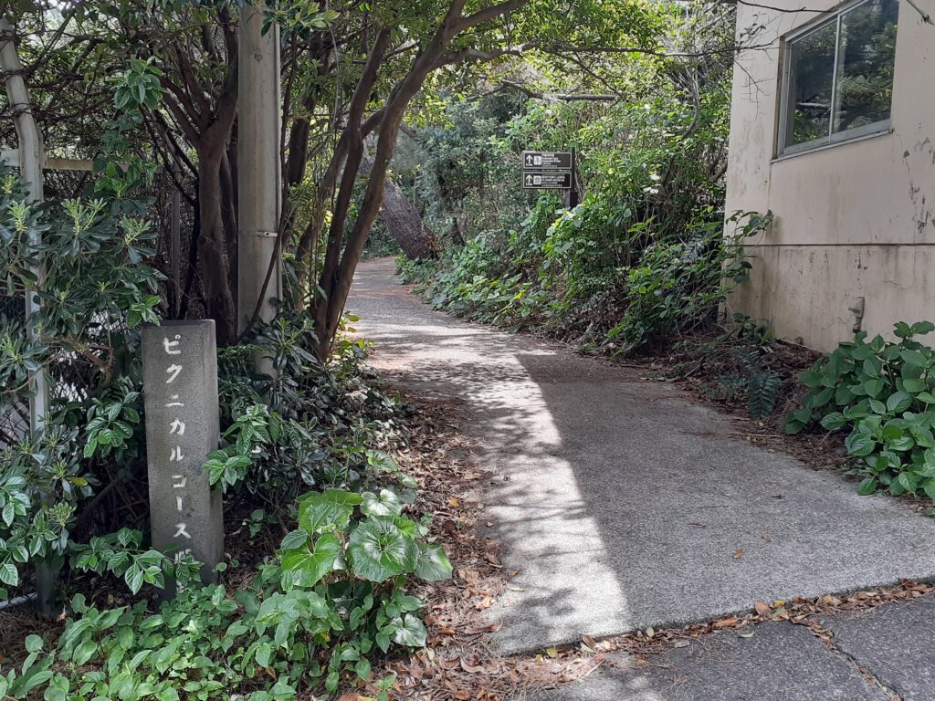
Entrance to Jōgasaki Coast Picnic Course
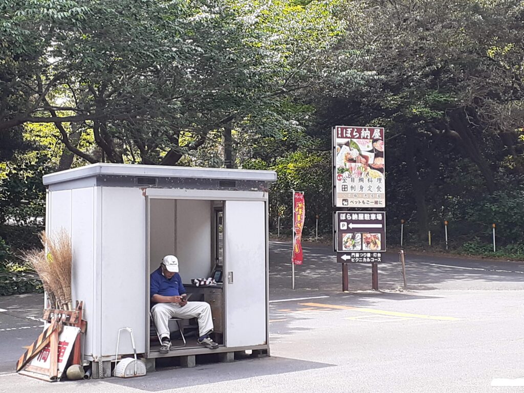
You will see a restaurant called Bora Barn and its parking lot. The Jōgasaki Kaigan Hiking Course is on the other side of this Bora Barn, turn left and cross the parking lot.
There was a man in the car park, so Mai asked him about the route and he told us to turn right at the back here.
As informed, we passed by the Bora Barn on the other side of the car park and found a small path. This is the Jōgasaki Coast Hiking Trail.
Walking on, we came to a place marked as the Picnic Route.
Ruins of gun emplacements to protect the Black Ships
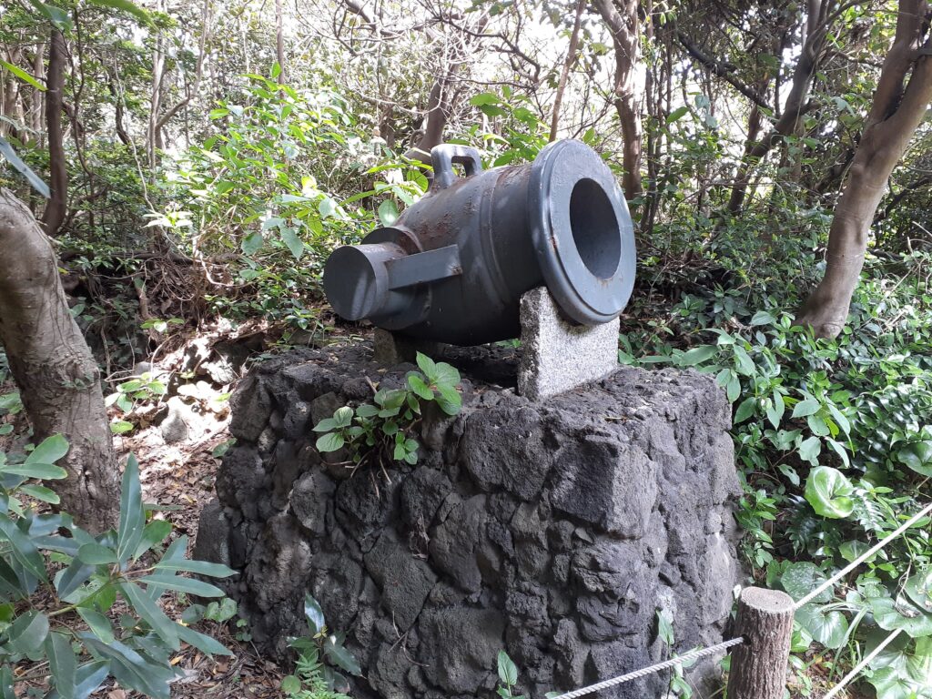
A short walk takes you to the remains of a gun battery. It was set up to defend Japan after the arrival of the Black Ships.
This picnic trail is 3 km long and is designed as a hiking trail that can be enjoyed by beginners. It is therefore paved with concrete and other materials to make it easy to walk on.
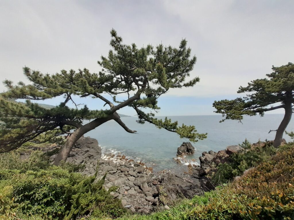
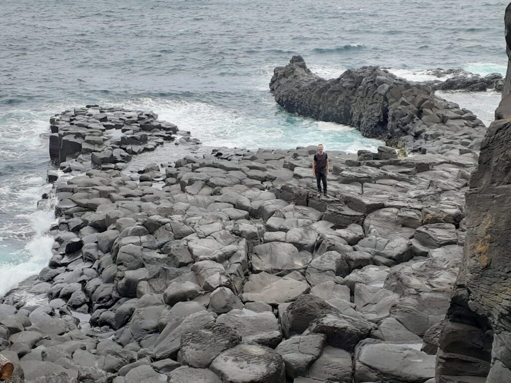
Jōgasaki Coast (National Park)
Soon we arrived at the main spot of the picnic trail, the National Park Jōgasaki Coast and Kadonowaki Suspension Bridge.
Visitors can walk along the lava coast that juts out into the sea. Quite a lot of plants were growing in the gaps between the volcanic rocks. The Jōgasaki coast, which is made up of lava flows, also seems to have many different plants growing wild.
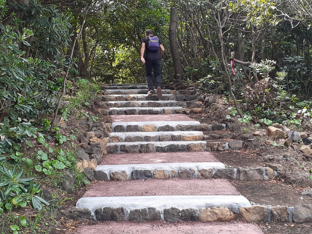
There are well-maintained stairs that lead up to a suspension bridge.
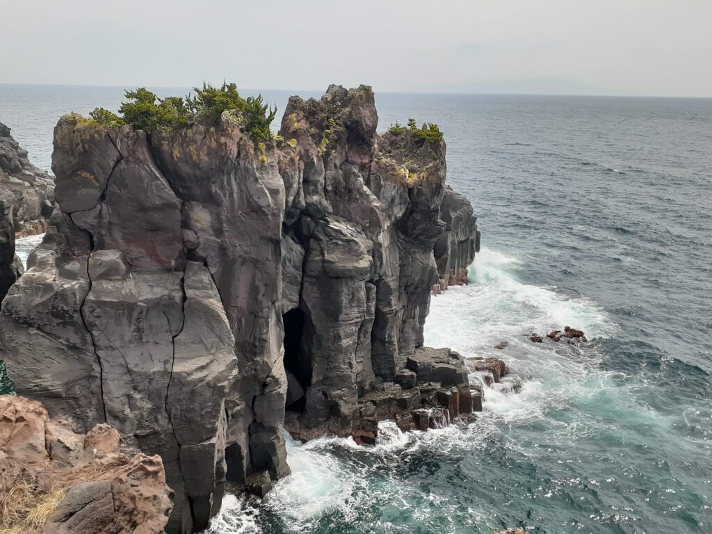
The waves were crashing heavily on the rocks on the beach. Be careful when walking on the rocks, as there are no fences or handrails!
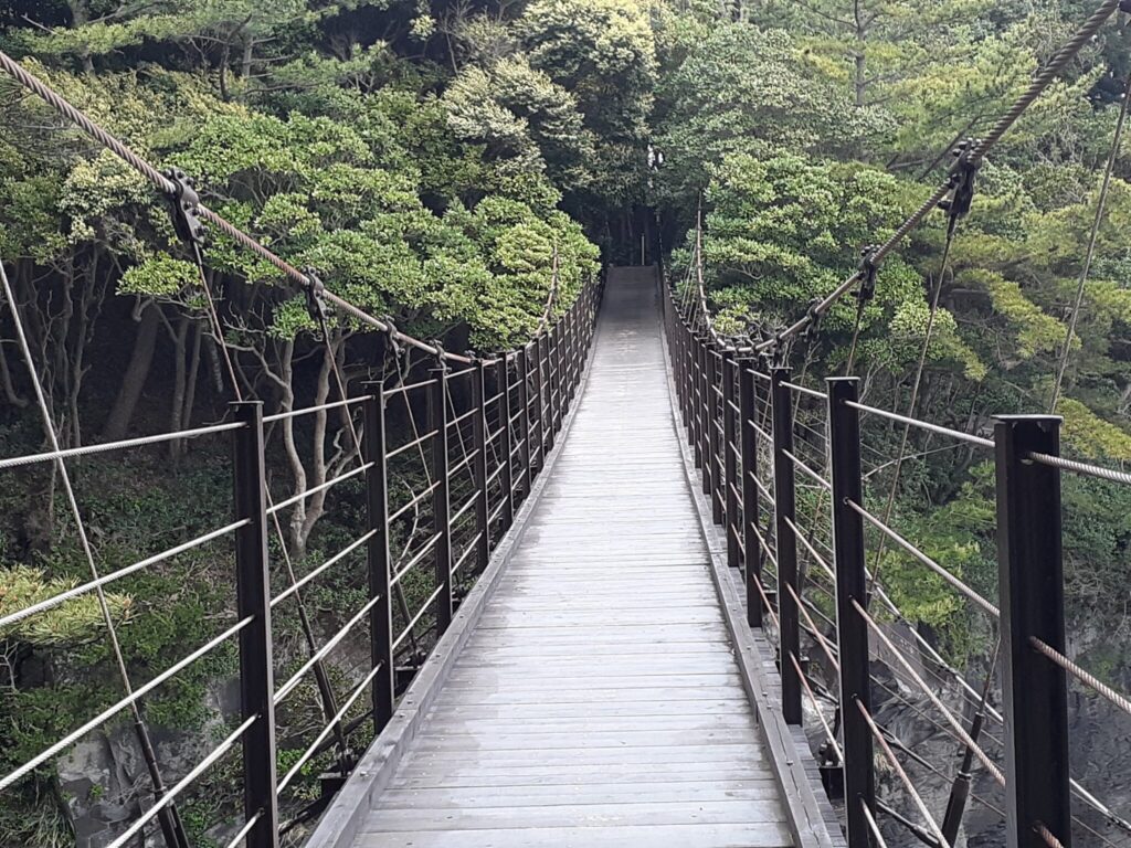
Kadowaki Suspension Bridge & Free Lighthouse Views
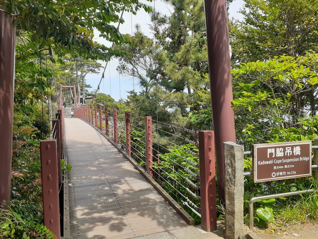
Kadowaki Suspension Bridge comes into view. The suspension bridge is 48 metres long and 23 metres high. It is quite rocky.
There is also a national park monument across the Kadonowaki Suspension Bridge. It seems that many people drive here and only explore the coast and the suspension bridge area.
Kadowaki Lighthouse
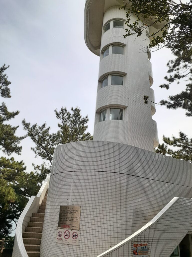
There is a lighthouse across the Kadowaki Suspension Bridge. It was marked ‘free to visit’, so we went up the stairs.
We walk on and on past Kadonowaki Lighthouse. There are fewer and fewer people. This area is still part of the Picnic Trail and the footpath is easy to walk on.
Anaguchi (Hole mouth)
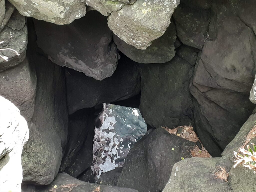
After a short distance, we stopped at a sign saying ‘Hole Mouth’. There is a hole by the side and you can see the sea surface below. The waves were lapping violently here too.
From this area, there is a sign saying ‘New York Lamp Museum and Flower Garden’ (in English for some reason), so walk towards it.
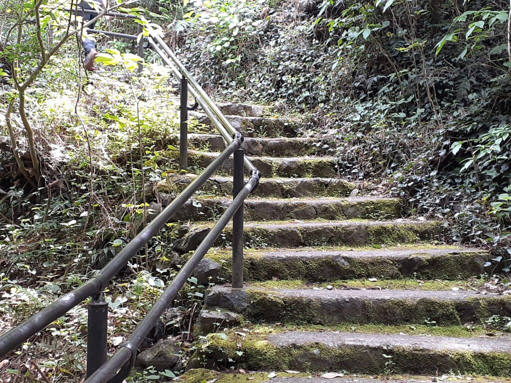
After the stairs with handrails, the Jōgasaki Picnic Trail is about to end when you reach the asphalt path.
A Quirky Pitstop: The New York Lamp Museum
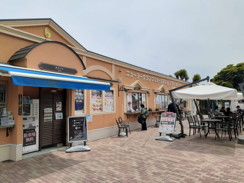
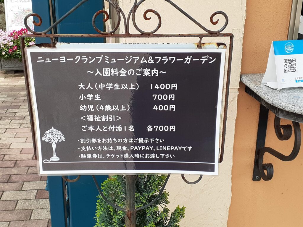
The New York Lamp Museum and Flower Garden is a Western-style building that suddenly appears. We didn’t understand why the New York Lamp is in such a place, but the entrance fee is expensive, so we didn’t go in.
The museum is a tourist attraction, but it has a forced feel to it. This is a common pattern in Japanese tourist attractions(according to my Japanese wife).
Anyway, this is the end of the Jōgasaki Picnic Course. From here onwards, the Nature Trail hiking course starts.
Phase 2: The Jogasaki Nature Study Path (Rugged & Wild)
Crossing in front of the New York Lamp Museum and Flower Garden, turn left and zoom along the asphalt path until you see the entrance to the temple.
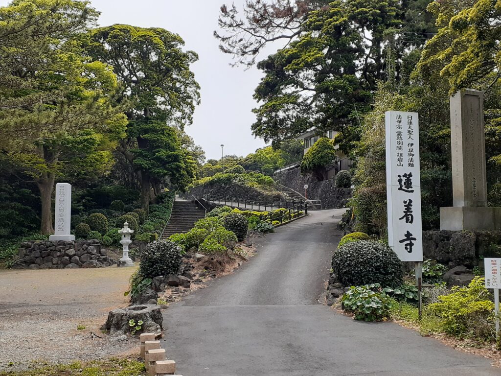
Renjiki-ji Temple. Go up the entrance stairs. This area is well visible on Google Maps.
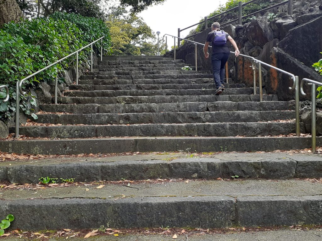
Climb the entrance stairs to see the main hall. There are also stairs in front of the main hall, but these do not need to be climbed.
As you continue in the direction of travel, you will see a toilet and next to it is the entrance to the nature trail.
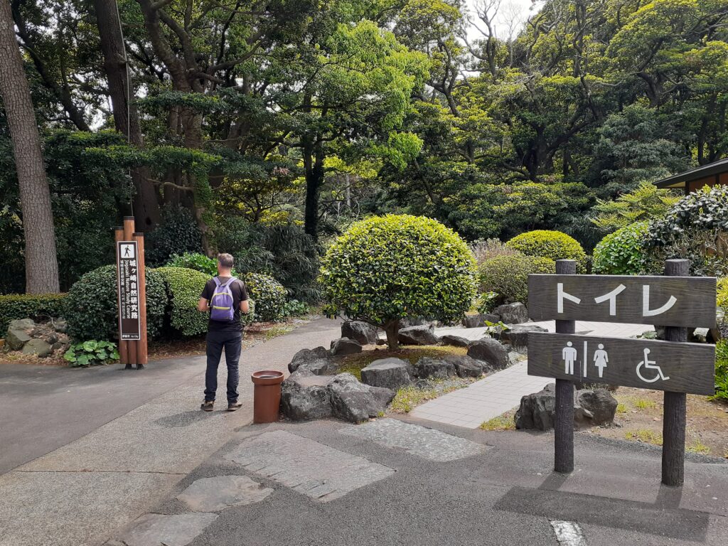
We ate our lunch in the precincts of the temple and continued walking again.
Columnar Joints and Spiky Lava Fields
After a while, we saw a sign saying Ishiokui Mochinoki (Stone-eating Mochinoki). We went and saw that there was indeed a tree eating a stone.
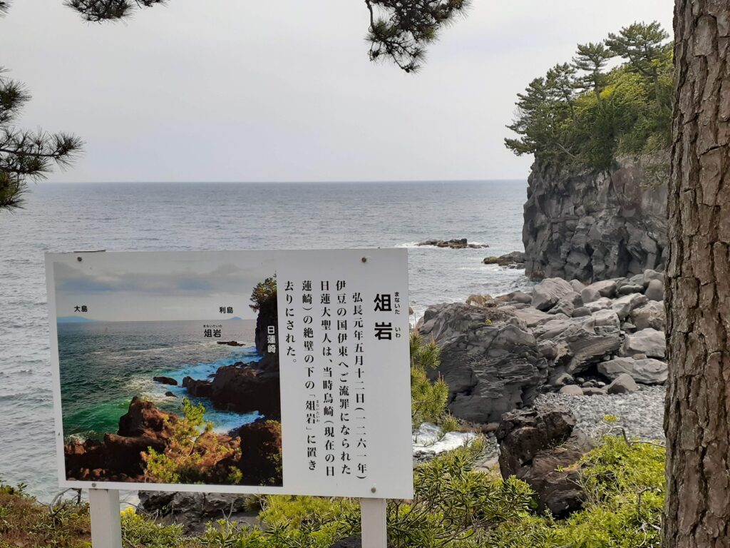
Soon you come to a slightly open area. The inner sanctuary of Renjiki-ji Temple is here, and on the beach opposite it’s marked ‘Manaita Iwa’. It is said to be the place where Nichiren Shonin was exiled a long time ago.
There is a sign next to the inner sanctuary, so follow it up the stairs. It says it is 4.8 km from here to the next suspension bridge.
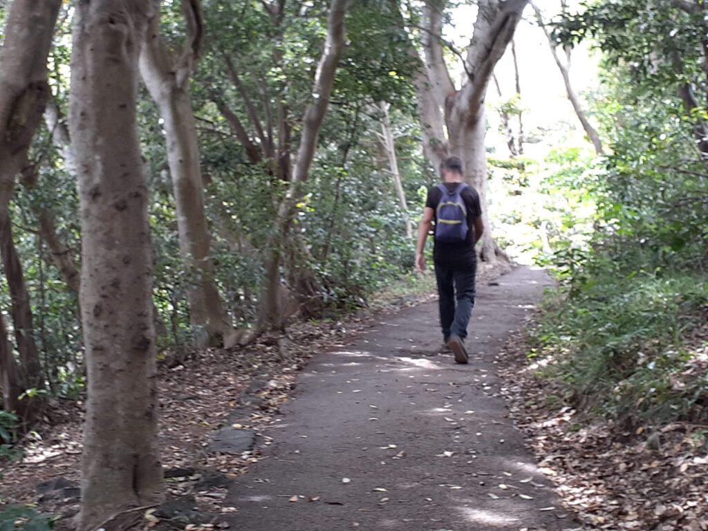
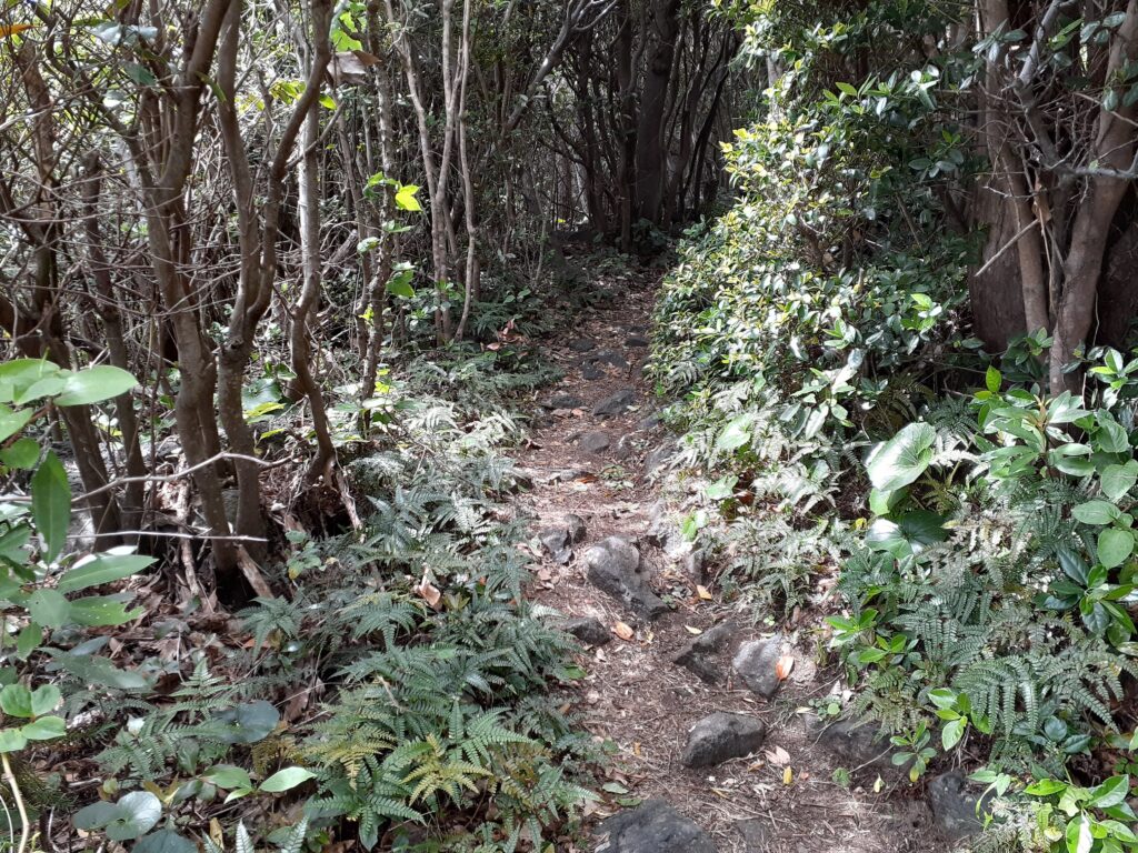
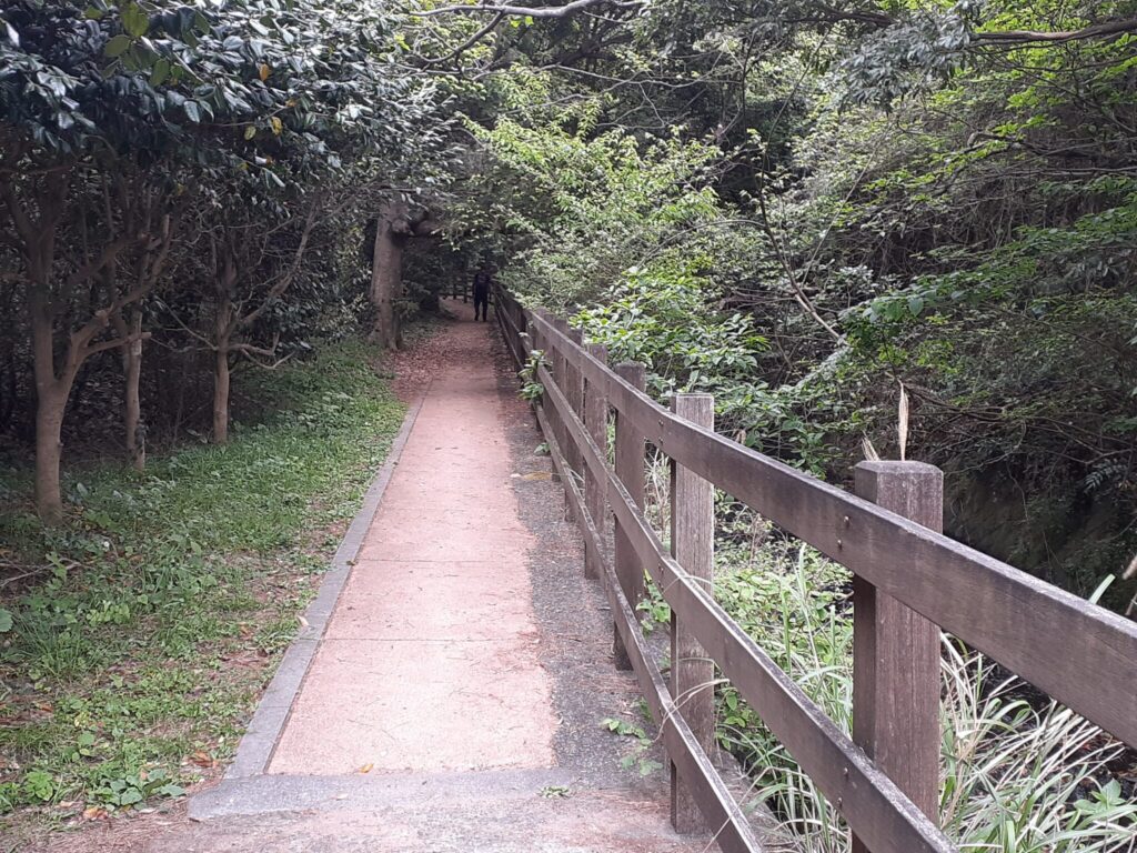
The Jōgasaki Picnic Trail has many paved sections that are easy to walk on, but the Nature Study Path is in a more natural state. You walk along a promenade with fallen leaves and pine needles on top of the soil.
Jōgasaki Kaigan has an intricate coastline, so there are many viewpoints all along the way. From the Toumidai you can look out over the whole landscape.
The Jōgasaki Coast was originally formed by lava flows, so it is littered with volcanic rocks.
Not many people walk from one end to the other of the hiking trails in Jōgasaki. We saw foreign tourists and domestic travellers at the sightseeing spots, but we saw very few people walking in other places. There are plenty of signs out there so you won’t get lost walking around!
There is a neat sign here too, which says that there is 4.2 km to the Hashidate Suspension Bridge.
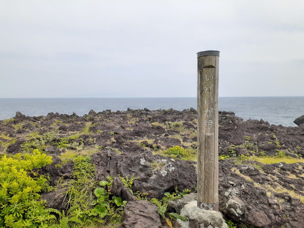
The name “Igaiga-ne (Spiky Root)” is a little intriguing. When we went there, we found that there were indeed rocks strewn all over the place. The surface of the volcanic rock is rugged and sharp. When lava cools and hardens, it hardens from the surface, but the cooled and hardened surface is broken into pieces by the lava that flows in afterwards, resulting in a spiky surface.
This is another large terrace-like area where visitors are free to roam.
There was a sign for ‘Tengu no Hana’, but nothing like it was found in the vicinity and no accessible paths could be found. Presumably the path leading to it has been left blocked by trees.
The area is a bit easier to walk around, with no hills or steps.
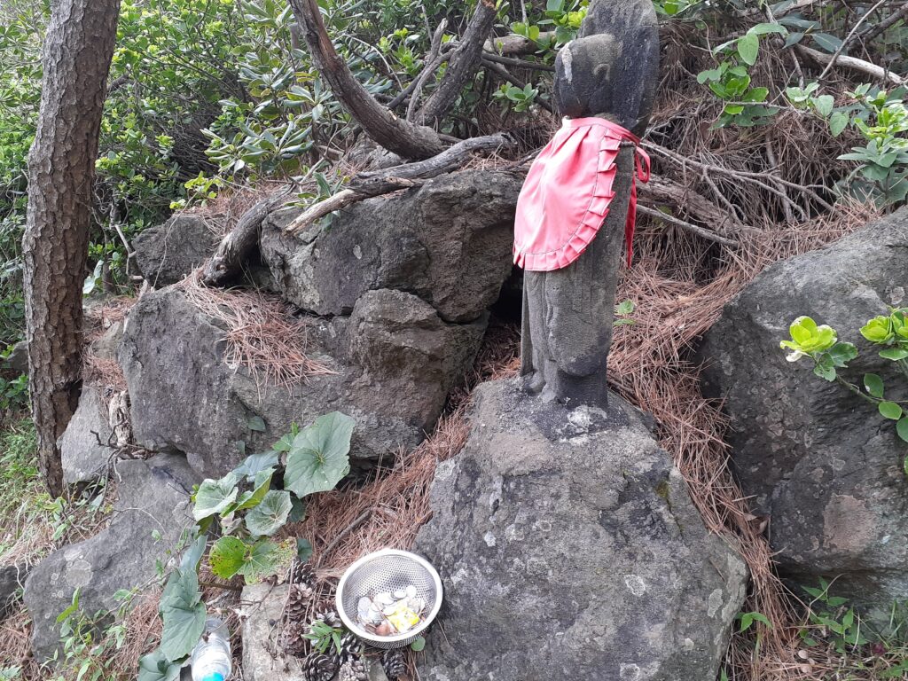
There is a small Jizo and the slope appears again. Continue onwards towards the Hashidate Suspension Bridge, enjoying the views that open up from time to time.
The wind is gradually picking up and the sea is getting wild. The path is narrow, and in some parts it resembles an animal trail.
Tsushima Falls & The Hashidate Suspension Bridge
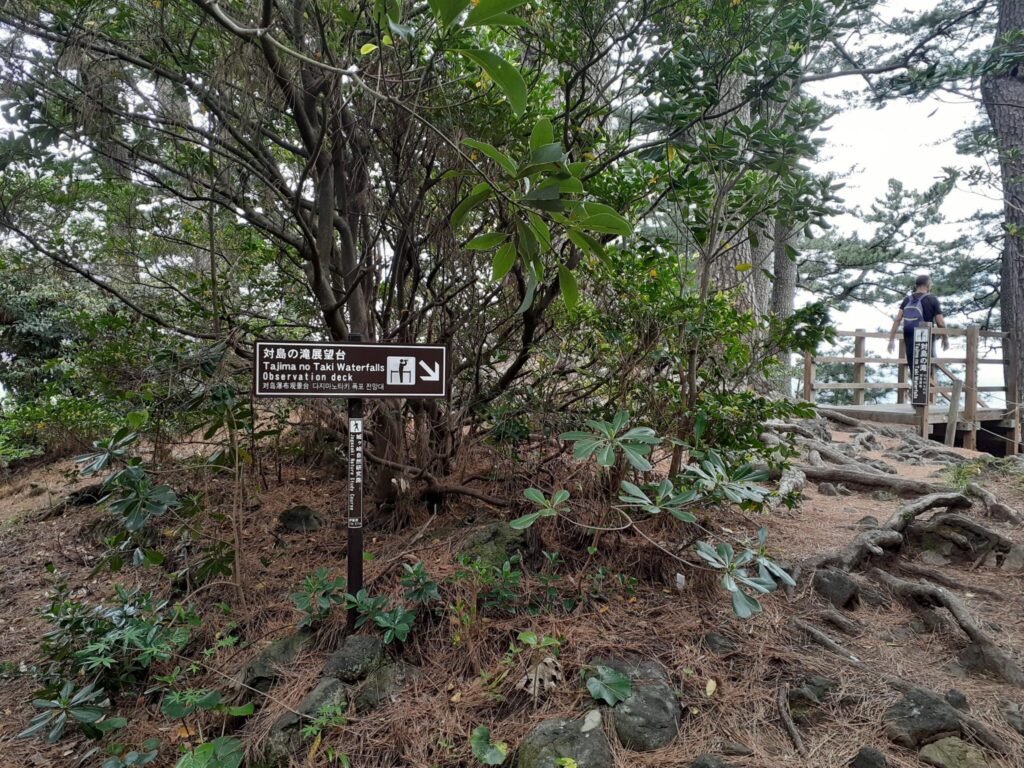
A sign says ‘Tsushima Falls Observation Deck’, so we stop by.
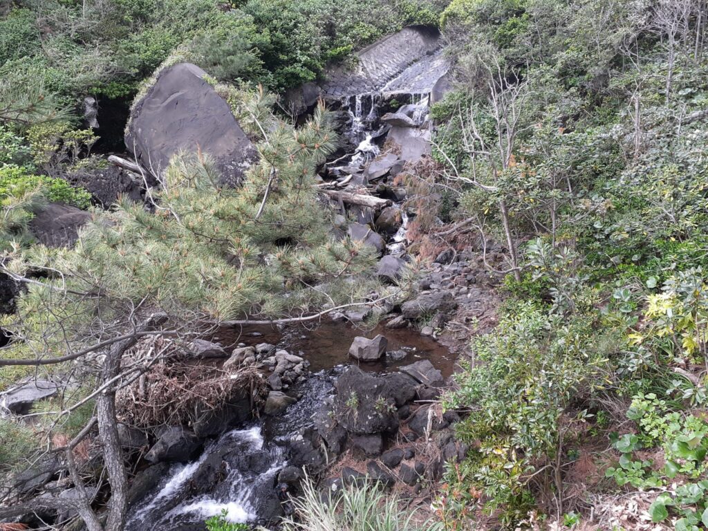
You can look down at the waves crashing violently against the shore. Turning your gaze to the right, you can see the spout of the Tsushima Falls, which cascades down from the rocks in front of you into the sea.
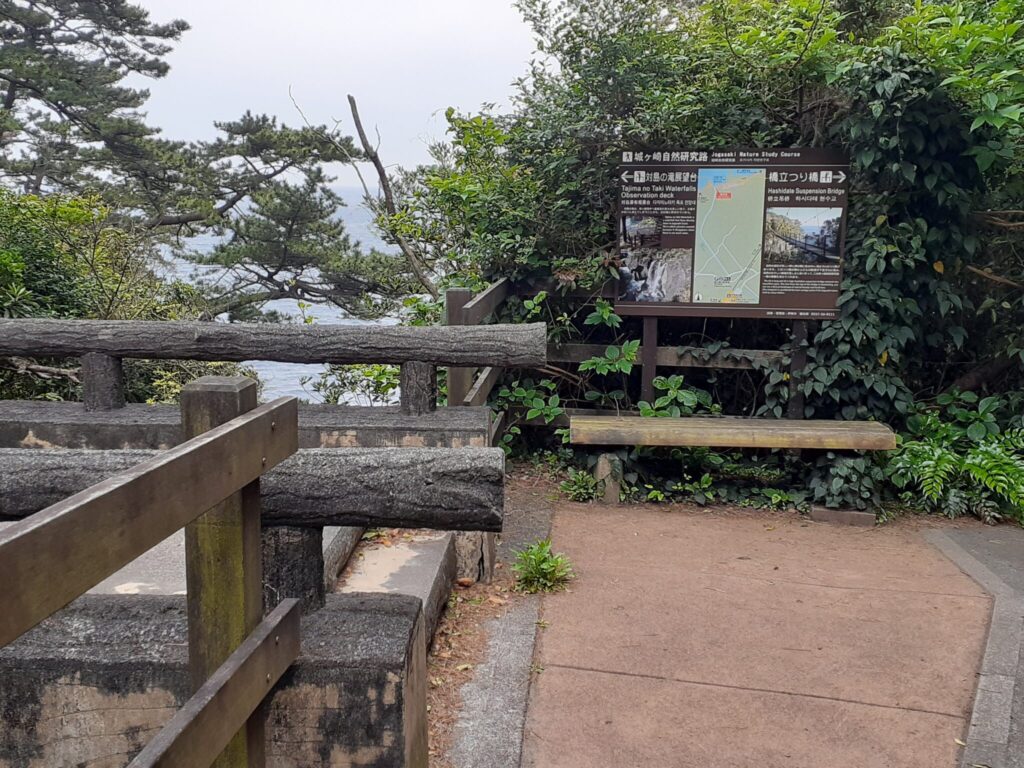
Further on past the Tsushima Falls lookout, you will come to a small concrete bridge. This will cross the water flow of the Tsushima Falls seen earlier from the observatory.
After crossing the concrete bridge, you will see a map of the hiking trail and continue in the same direction to reach the Hashidate Suspension Bridge. Cross the bridge and follow the pathway extending to the right to JR Izu Kogen Station.
Having crossed the Kadonowaki Suspension Bridge on the Jyogasaki Picnic Trail, the Hashidate Suspension Bridge on the Nature Study Path has a different atmosphere. We thought we would finish this hike by crossing this bridge, but before we did, we stopped at the “Oyodo and Koyodo” attraction.
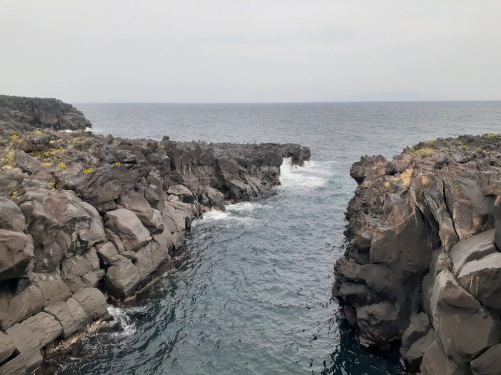
Oyodo and Koyodo
Oyodo and Koyodo has a strange landscape, which looks like countless pillars folded together. The regular cracks created by the volume of lava shrinking as it cools are called ‘columnar joints’, and these interesting landscapes are the result of a series of columnar joints.
Hashidate Suspension Bridge
Finally, the Hashidate Suspension Bridge. It is 60 m long and 18 m high.
It was quite rocky. The capacity is 20 people which was not a problem for us as there were no other hikers. Incidentally, there seems to be a diversion for people who are afraid of heights.
Cross this bridge to the other side of the river and go back the way you came.
Go back over the bridge you crossed and return to the concrete bridge over the Tsushima Falls. Before the bridge, turn left and walk to Izu Kogen Station.
From here to JR Izu Kogen Station, I think we walked for about 15 minutes. We were staying in Atami at the time, so we took the train back to Atami Station from here.
The Perfect Finale: Riding the Red ‘Kinme Train’ Back to Atami
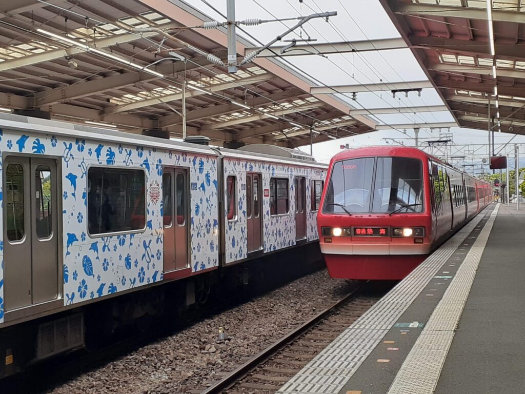
Take the train bound for Atami to the last station, Atami. A bright red train entered the platform.

When you get on the train, it is designed so you can sit facing the window. I didn’t know I was getting on a fancy train, but it is called a ‘kinme-train’. It is said to run along the east coast of Izu as a regional promotion train. The train is designed with the motif of the kinmedai, one of Izu’s most famous tourist attractions.
The Izu coastline has beautiful scenery, so it’s nice to be able to sit facing out the big windows. What’s more, I realised after getting off at Atami Station that the front-facing seats in the first car of this train were terraced so that you could enjoy the forward view. I hope to be able to take this carriage next time!
More Japan Hiking & Travel Guides
Loved this rugged volcanic trek? Check out more of our slow travel adventures around the region:
- ➡ Missed the start of our journey? A Half-Day Walking Tour in Atami: Sun Beach, Kinomiya Shrine & Panoramic Views
- ➡ Looking for another historic trek? Walking the Old Hakone Highway: Hakone Checkpoint to Yamanaka Castle Ruins (approx. 7 km)
- ➡ Explore more: Chubu & Izu Peninsula Guide | Japan Transport & Rail Guide
Comment
Thank you for created such a useful article !
As we are located on the trail, we will recommend it to our guests if they need more detailed information about the hike
And please don’t hesitate to come see us if you want to come back to enjoy natural hotprings and ocean view in the jogasaki coast