We went to Mishima City, Shizuoka Prefecture and would stay the night. Because we arrived in Mishima in the morning we decided to leave our luggage at the hotel and go sightseeing.
The primary purpose of our visit to Mishima City was to walk along the Old Hakone Highway. Before that, we had a little time so we also went sightseeing in Mishima City.
🇯🇵 この記事を日本語で読む: 箱根旧街道を歩く: 箱根関所から山中城跡(約7km)
- About Mishima City
- Walking along the Old Hakone Highway
- Bus from Mishima Station to the Hakone Sekisho (Checkpoint)
- Hakone Sekisho (Checkpoint)
- Old Hakone highway lined with cedar trees
- Entrance to the stone-paved road of the Hakone Old Highway
- Yamanaka Castle Ruins
- Bus to Mishima Station
- Other sightseeing spots in Mishima
About Mishima City
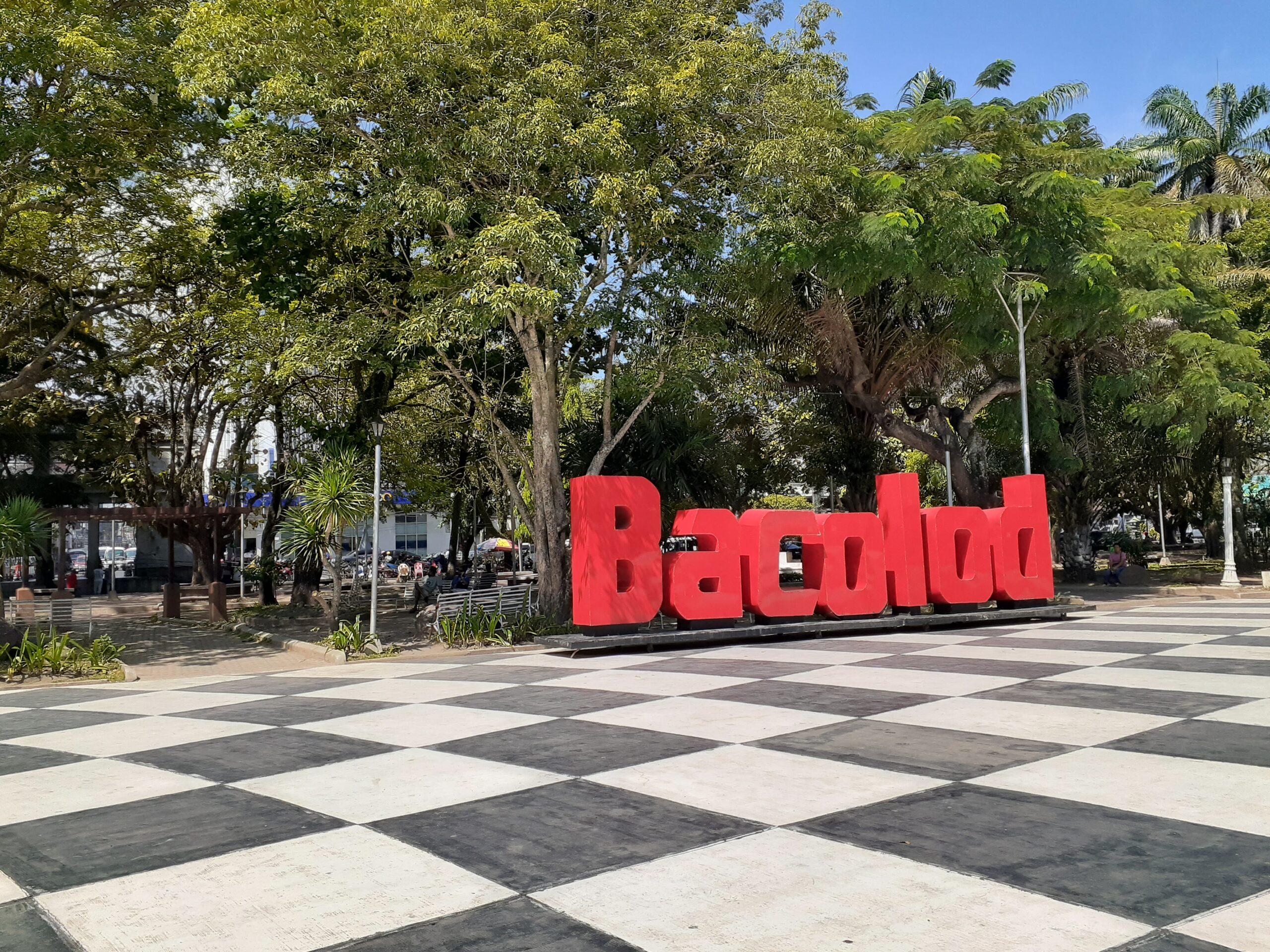
Mishima City is located in the eastern part of Shizuoka Prefecture, at the base of the Izu Peninsula. The population is approximately 100,000 (estimated 2023).
The city was once the seat of the national government of Izu Province and prospered as a post town on the Tokaido Highway leading to Hakone.
We stayed overnight near JR Mishima Station and spent a day sightseeing by public transport and on foot.
Read more about Mishima Travel Guide:
➡ Mishima Travel Guide: Pristine Fuji Spring Waters and Shrines
Walking along the Old Hakone Highway
Mishima flourished as a post town on the Tokaido Highway linking Edo and Kyoto in the Edo period. It played an important role as a resting place before and after Hakone, which was said to be a difficult route.
The road connecting Mishima and Odawara across the Hakone Pass is the Old Hakone Highway. It is said to be the most difficult part of the Tokaido Highway because of its many slopes.
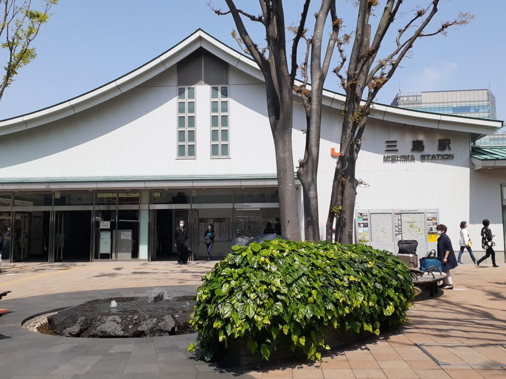
Bus from Mishima Station to the Hakone Sekisho (Checkpoint)
The route from Odawara to Mishima has been turned into a hiking trail known as the Old Highway and can be walked like the people of old. However, as mentioned earlier, the distance is long and quite hard. So this time, we attempted to walk the route from Mishima to Hakone Sekisho by taking the bus up to Hakone Sekisho (Checkpoint) and then walking down.
To get to Hakone Sekisho (Checkpoint), take the bus (N65) from JR Mishima Station to the old Hakone Station and get off at Hakone Sekisho Ato.
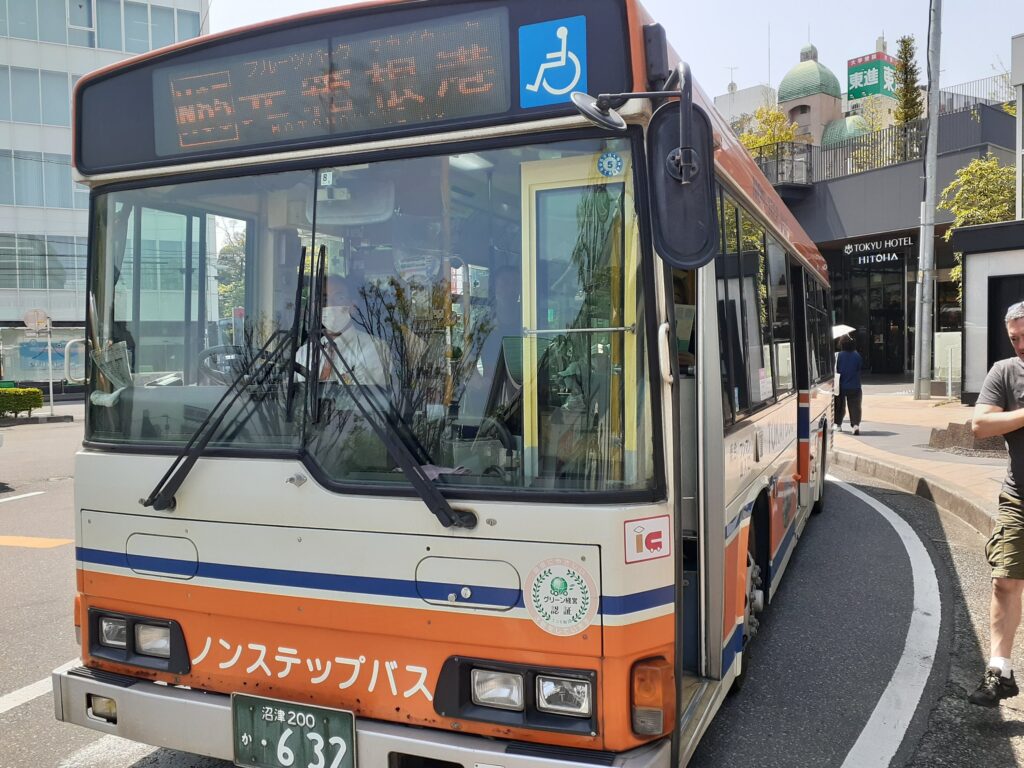
There is only one bus every hour to Hakone Sekisho Ato. The N65 bus only goes as far as the Hakone Sekisho.
We had almost an hour before departure, so we killed time by visiting some of the sights around Mishima Station. The sights we visited before taking the bus are at the end of this article.
Once you get to Hakone Sekisho, there are some places to eat, but because it is a tourist area the prices are a little inflated. We decided to buy lunch at a convenience store and bring it with us and have a picnic.
We stopped at a convenience store on the way back to the station after looking around and arrived at the bus station at around 11:05. The bus was already full and some people were standing on the bus. The bus departed on schedule and after a little while seats became available as local people got off and we were able to sit down. Most tourists s got off at the Mishima Skywalk (400 m suspension bridge) and after that it was pretty much empty.
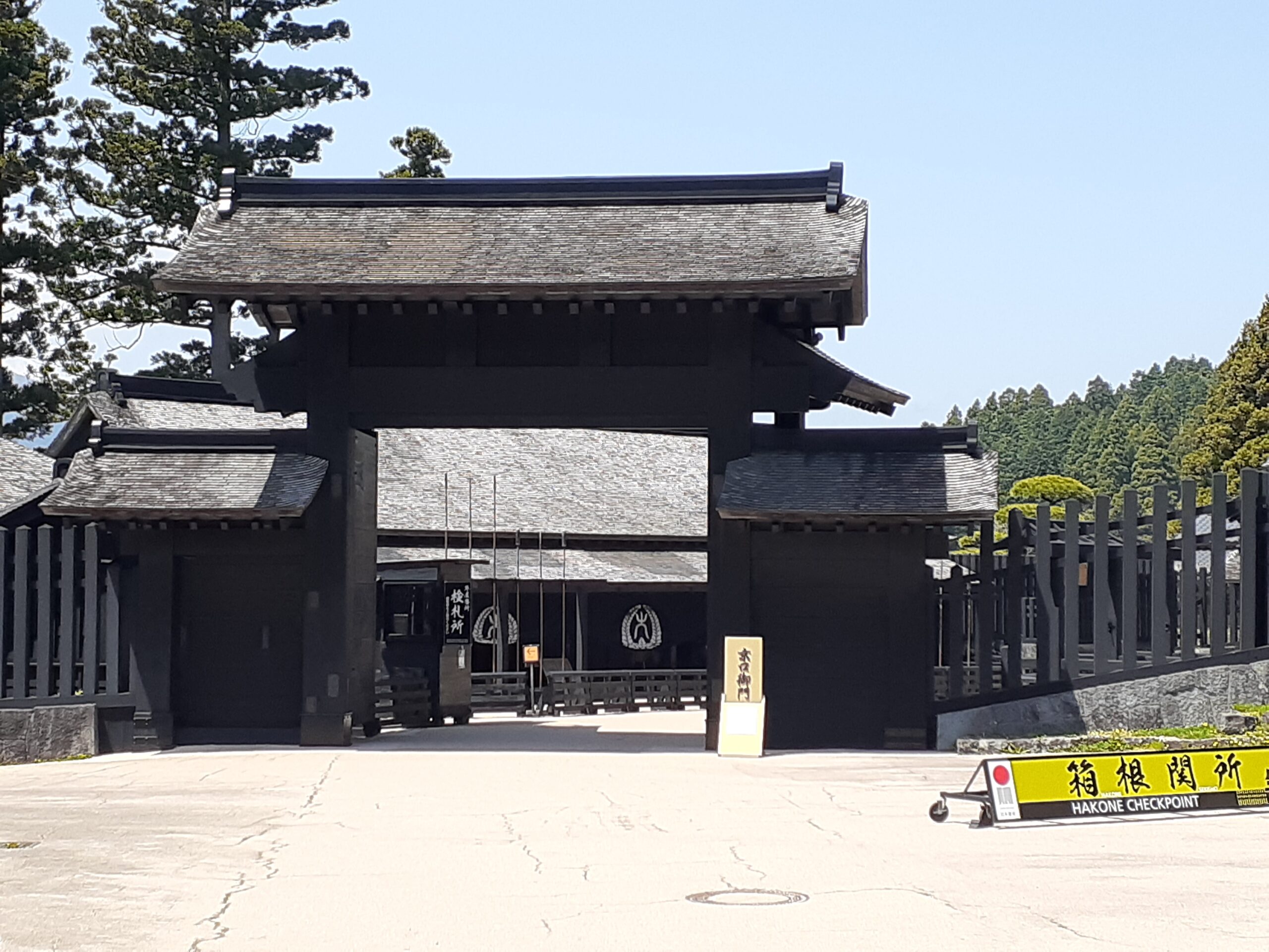
Hakone Sekisho (Checkpoint)
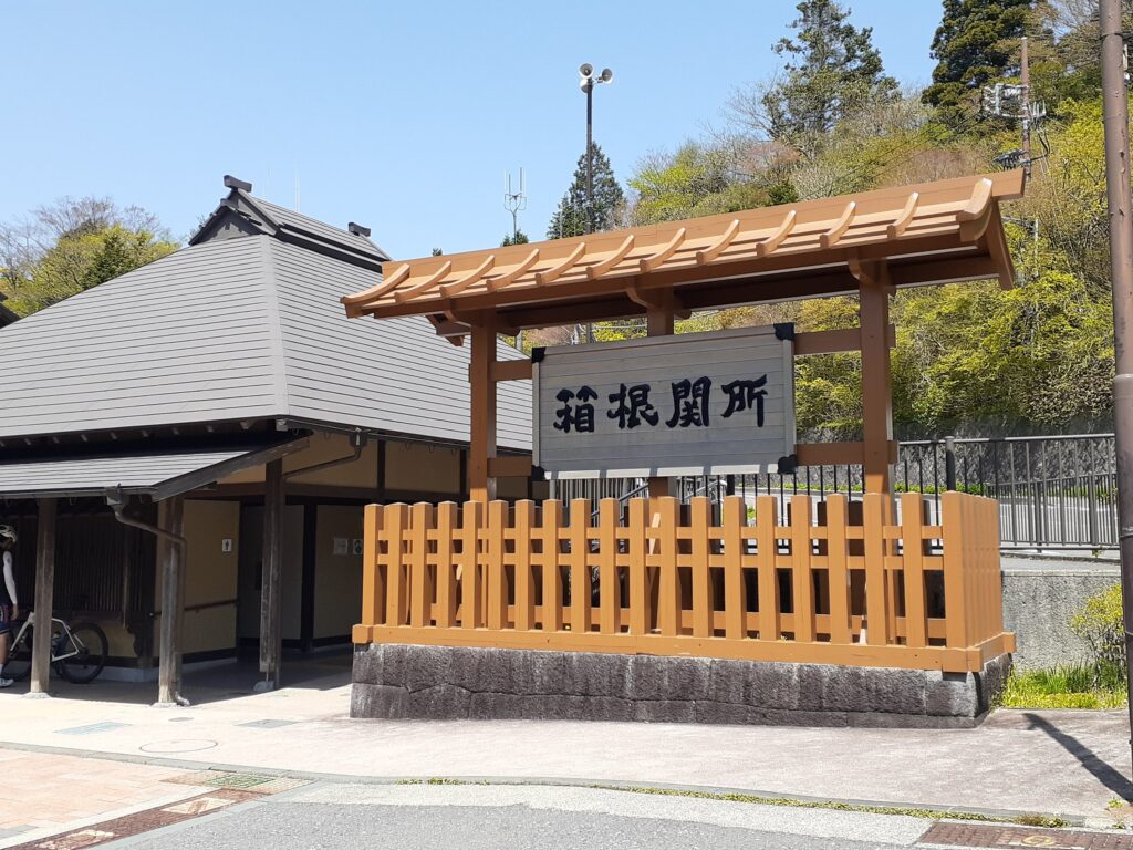
We arrived at the Hakone Checkpoint at around 12:15pm. The journey from Mishima Station takes one hour.
The Hakone Sekisho ruins are a tourist attraction with recreated buildings that remind us of what they should have looked like.

There’s an entrance fee to Hakone Sekisho Ruins. It would probably be a long walk and it was already quite late so we decided to start walking right away.
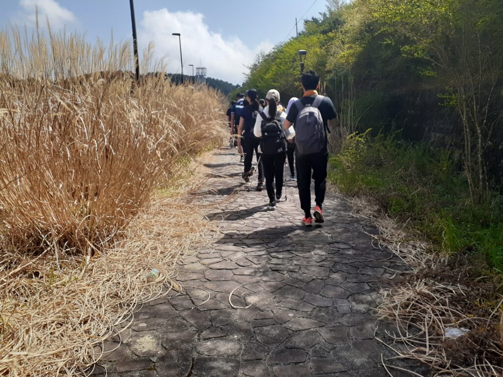
Old Hakone highway lined with cedar trees
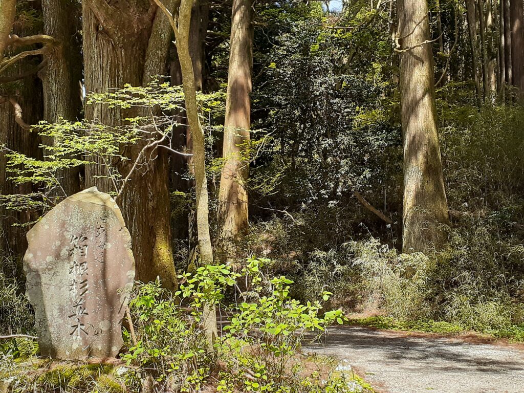
From the Hakone Sekisho ruins, we had planned to head immediately south towards Mishima, but when we looked on the map, we saw a sign nearby that said ‘Hakone Cedar Namiki’, so we decided to make a detour there.
From the Hakone Sekisho, we would once again head towards Odawara, walking only along the cedar avenue and then returning along the same road.
It was a long way around, but I’m glad we went. The path leads you between these towering cedar trees. Many Japanese are familiar with cedar forests, but for some foreigners it is a new sight. Really nice.

This area is around Lake Ashinoko. Many swan boats were lined up on Lake Ashi and we could see Mt Fuji on the other side of the lake. The travellers of old who came up the Hakone Pass must have been impressed by the sight of Mt Fuji.
We ate our lunch in a park near here. Finally, we walked along the old Hakone Highway.
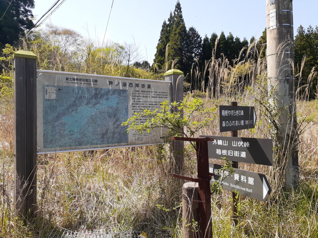
Entrance to the stone-paved road of the Hakone Old Highway
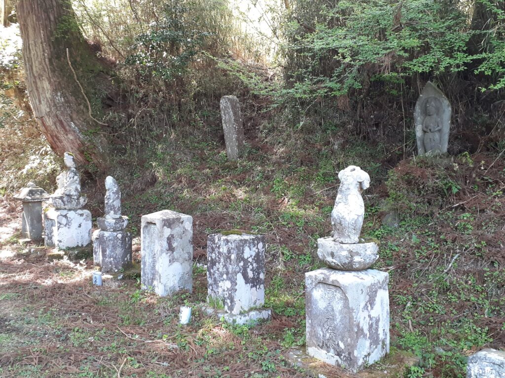
Return once to the Hakone Checkpoint and walk along the road in front of it in the direction of Mishima. A little further on, enter a residential area on the right and you will find the Bishamonten Torii (torii gate). Further on in the direction of travel, you will find the Ashigawa Stone Buddha Group, and behind it is the entrance to the Hakone Old Highway.
Google Maps works well, so we used it as a guide as we walked along.
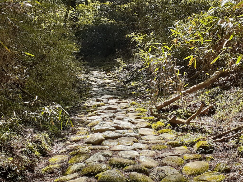
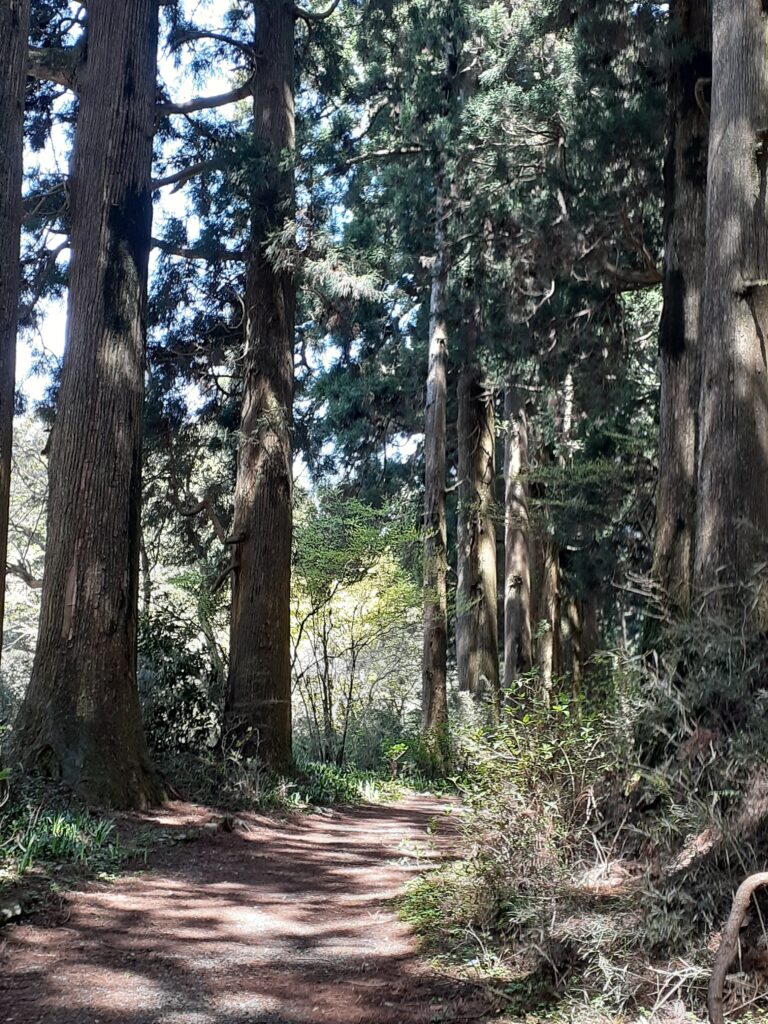
After walking a while you will reach a stone-paved path that is typical of the old highway. This area is still before the peak of the Hakone Pass, so it is uphill.
The Hakone Old Highway is part of the Old Tokaido Highway, which connected Edo, home of the Shogun, with Kyoto, home of the Emperor. The Old Tokaido Highway is known to have existed since around the 8th century, but it was not until the reign of Tokugawa Ieyasu (1543-1616) that it was properly laid out.
It was Tokugawa Ieyasu who paved the old highway with stones and made it a stone-paved road, whereas it used to be knee-deep in mud when it rained. The stone-paved paths are still there today, and we can walk along them like the people of the Edo period (1603-1868).

Although it is uphill, the gradient is not very steep. In addition to gentle slopes, there are also sections with steps.
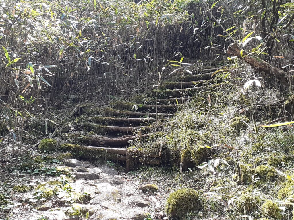
The Hakone Old Highway consists of a combination of paths in nature, as shown in the image above, and walking along the side of a modern roadway. Walking along the path in the forest leads to the roadway, and after walking along the roadway for a while you enter a small promenade again.
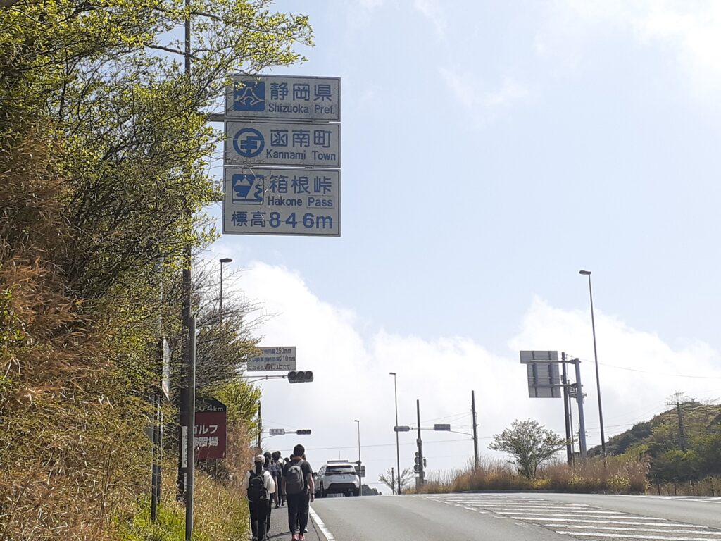
After walking gently up the sloping roadway, you will see a sign saying Hakone Pass 846m. This is the peak of Hakone Pass. After this it is basically downhill.
It was a weekday, but there was a group of people walking the entire 40 km old Hakone Highway from Odawara to Mishima. They left Odawara Station in the morning and walked to Mishima Station. They were hiking in several groups, so we were passing and being passed by each group as we made our way along almost the same route.

The Hakone Old Highway is a well-maintained hiking trail, with public toilets available at various points. Here is the sign for the entrance to the Hakone Old Highway next to the public toilet at the side of the road crossing. We also followed this sign,
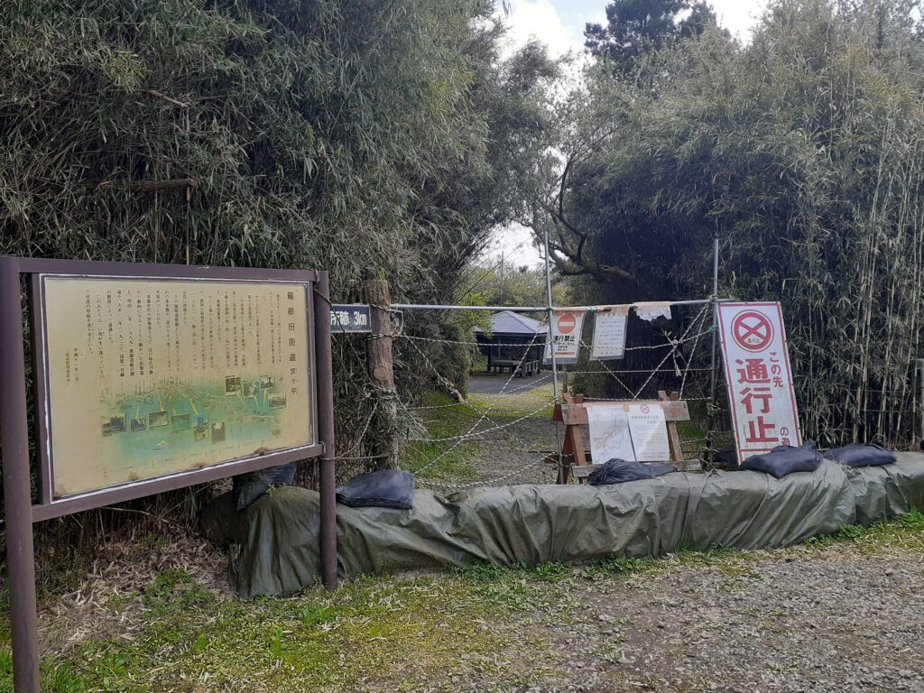
Unfortunately, this old highway was closed to traffic. The explanatory signs on the side of the road make it look like a nice path, but we had no choice. It was closed due to damage caused by bad weather a few years ago. We had no choice but to return the way we came to the public toilets and walk along the road to the next old road.
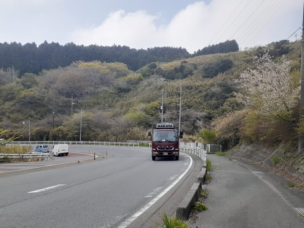
Even though it is a carriageway, the majority of it has a footpath, and there are parts where it is fairly wide. However, there are places where you have to cross busy traffic, so walk with care.
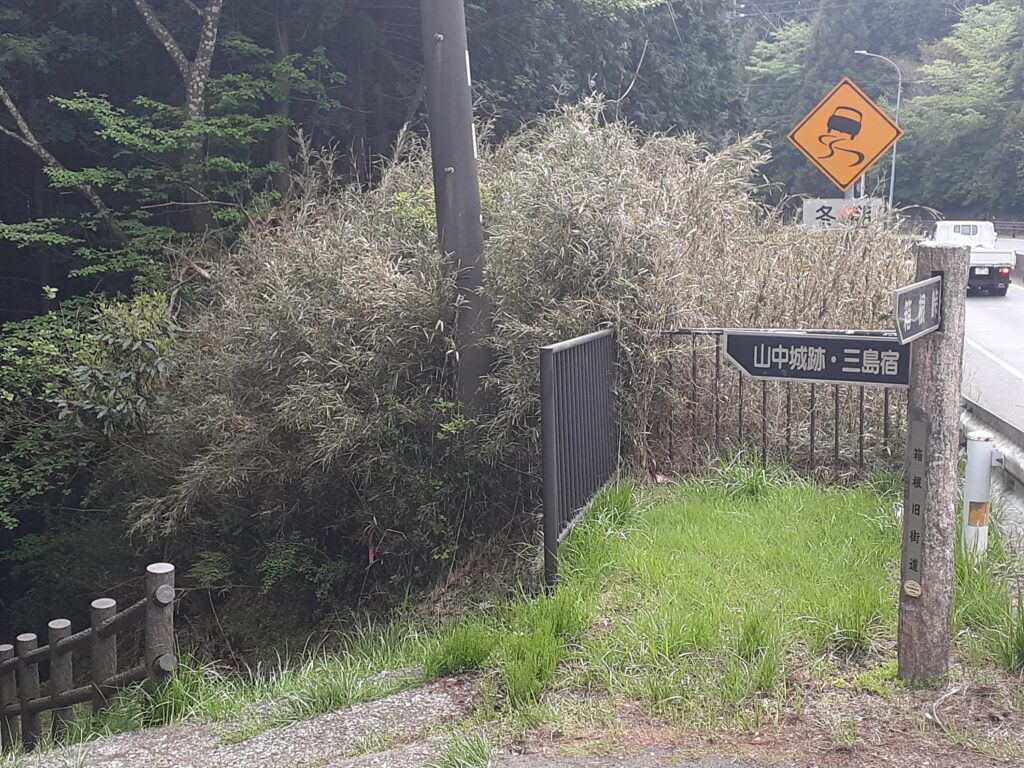
After a short distance along the road, the entrance to the old road is marked like this. Continue in the direction for “Yamanaka Castle Ruins, Mishima Inn”. Mishima-juku” corresponds to the centre of Mishima City. Mishima was a prosperous town as an inn before and after the Hakone Pass, which is why it is still marked as ‘Mishima-juku’.

The Kabuto Ishi (helmet-shaped stone) is a large rock that looks like a helmet. It seems to be so called because the large rock is shaped like a helmet.
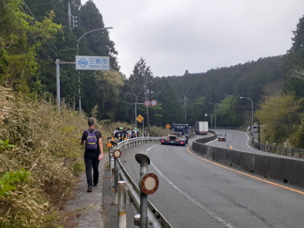
Walking along the roadway again, we saw a sign saying ‘Mishima City’. Finally, we are back in Mishima City.
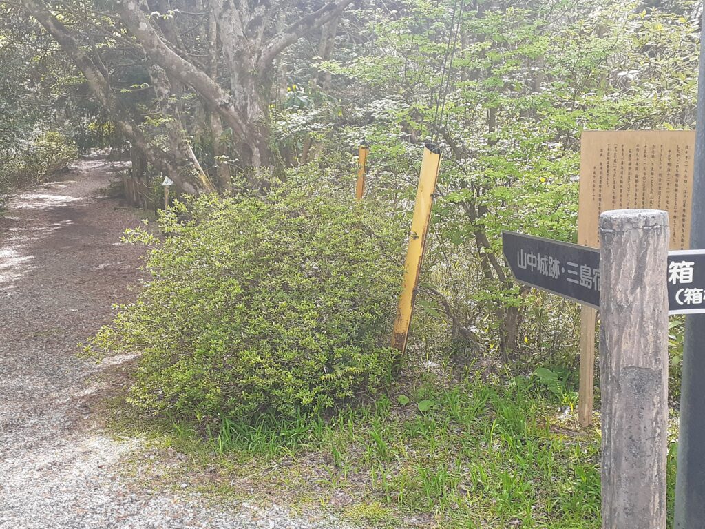
Once again, we entered the countryside from the roadway. A local man we met on the way suggested that we should visit Yamanaka Castle Ruins, which is a wonderful place to visit. So we followed the ‘Yamanaka Castle Ruins’ sign walking at a brisk pace.

Some paths are cobbled, others are surrounded by bamboo bushes and thickets, while others are lined with cedar trees, such as this one.
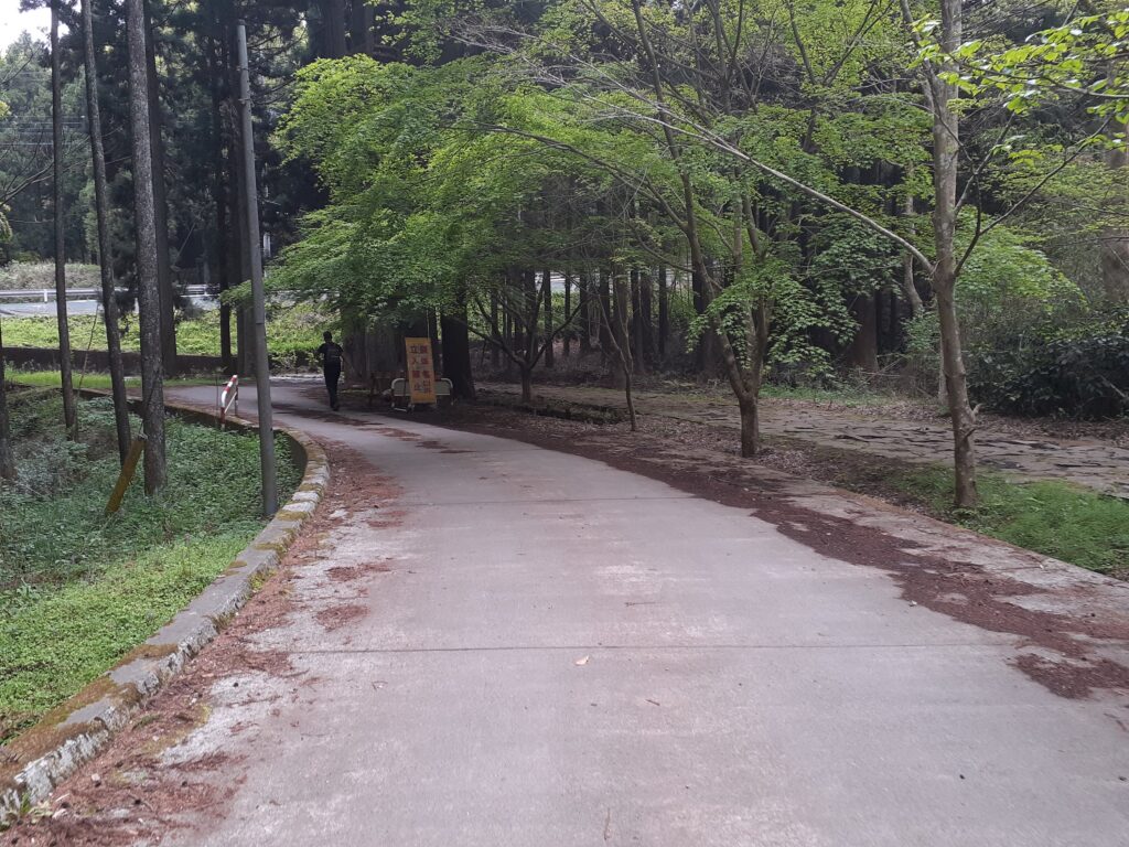
Following the signposts for Yamanaka Castle Ruins, you suddenly come to a wide concrete path. Yamanaka Castle Ruins appears to be close.

When you see the footbridge, you are almost at Yamanaka Castle Ruins. Across this bridge is the entrance to Yamanaka Castle Ruins.
Yamanaka Castle Ruins
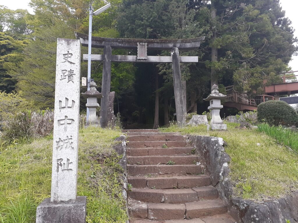
After crossing the footbridge, you have arrived at Yamanaka Castle Ruins. Enter the grounds by going up a few steps. There is no entrance fee.
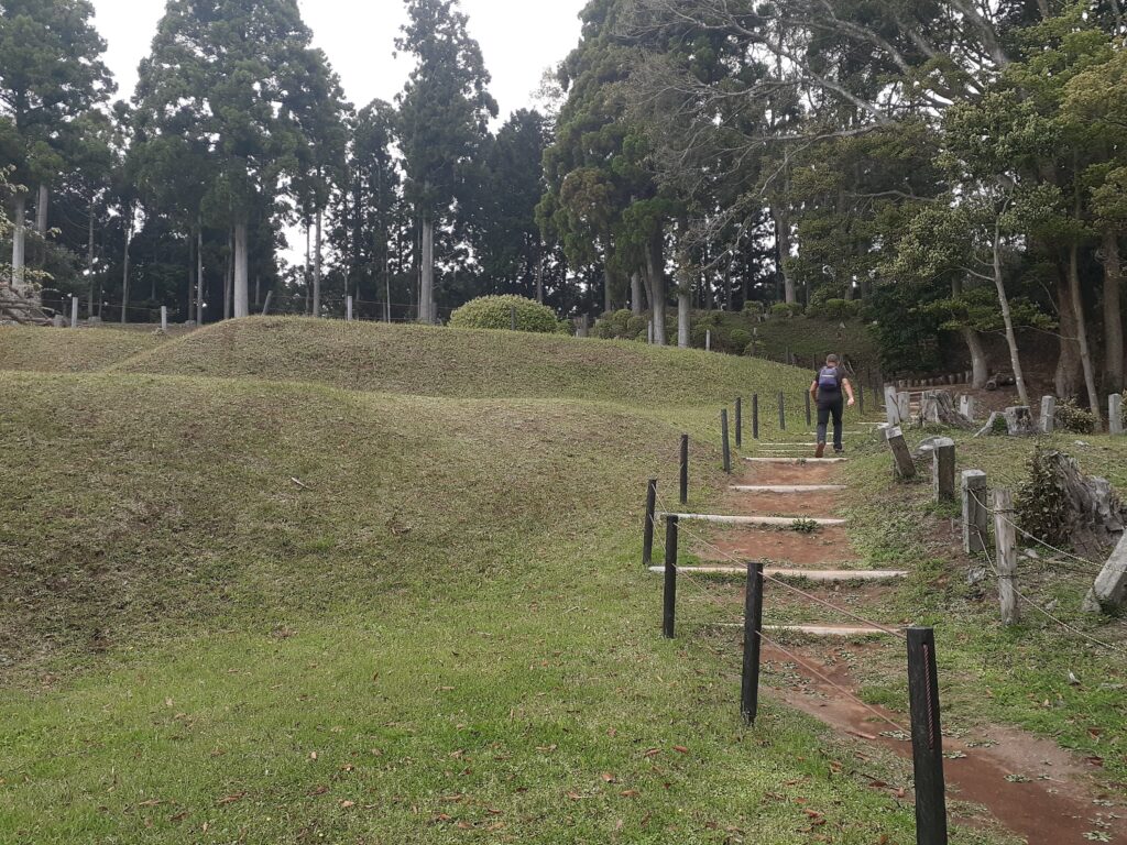
Although this is a castle ruin, no castle buildings remain. The large site has plants and promenades, allowing visitors to walk around as if they were strolling through a garden.
The grounds are quite large and there is a map of the grounds near the entrance. The highlight is the view from the far end, i.e. the highest point.
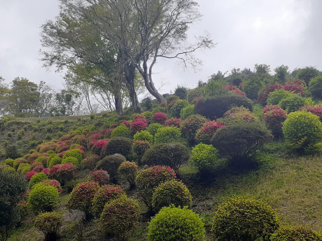
Unfortunately, the weather was also downhill on this day, as if in response to the descent down the hill. It was completely overcast at this point. The sky was such that we did not know when it was going to rain. So we didn’t get the view we were hoping for, but the azaleas in the garden were in bloom and beautiful.
Bus to Mishima Station
After visiting the Yamanaka Castle Ruins, we headed towards the exit/parking area and found a bus stop. Just as we were checking our route on the map, a bus bound for Mishima Station passed by. We jumped on it and finished the hike.
We left Mishima Station on the 11:15 am bus and returned to town at around 4:30 pm. The distance we hiked was probably about 12 km.
Other sightseeing spots in Mishima
As mentioned above, we had quite a bit of time to wait for the bus to Hakone Sekisho Ruins, so we did a bit of sightseeing around Mishima Station during that time. Here are some of the spots we stopped at. Read more about Mishima Travel Guide:
➡ Mishima Travel Guide: Pristine Fuji Spring Waters and Shrines
➡ Back to Chubu & Izu Peninsula Guide
Comment